- Object Name
- Object ID
98.139.1
- Maker
- Title
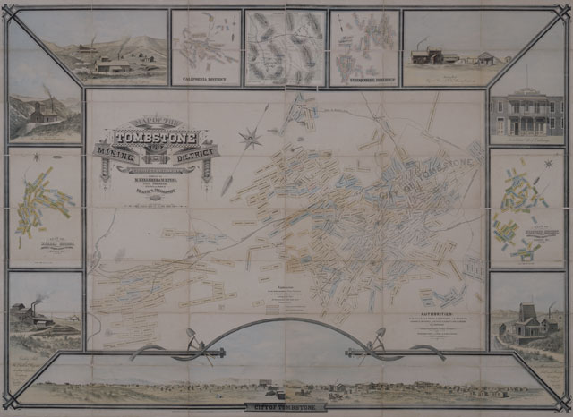
Map of the Tombstone Mining District
- Date
1881
- Materials
lithograph
- Dimensions
H: 50 3/4 in, W: 67 3/4 in, D: 1 in
- Credit Line
Donated by Petra and Greg Martin, the Autry Museum
- Category
Maps
- Remarks
Color lithograph pictorial map of THE TOMBSTONE MINING DISTRICT in Cochise County, Arizona Territory, compiled by M. Keleher and M.R. Peel, designed and drawn by Frank S. Ingoldsby, 1881. The map depicts patented mining claims in the Tombstone Mining District with twelve pictorial vignettes surrounding the central map image. One image, center of top, depicts the boundaries and principal topographical features of Cochise County, Arizona Territory. Four images depict patented mining claims in the nearby mining districts of Warren, Hartford, California and Turquoise. The remaining seven images are illustrations of the city of Tombstone and prominent buildings in the area.
- Subject

